
COMPLETED RESEARCH
Crop Yield Prediction with High Resolution Satellite Image and Deep learning model: A Case Study in Naldanga Subdistrict, Natore, Bangladesh
Research Funding: Planet
Faculty Researcher: Prof. Sara Nowreen
Collaboration: Lead: IWFM, BUET, Affiliate: CSE, BUET
Duration: September 2023 - September 2024
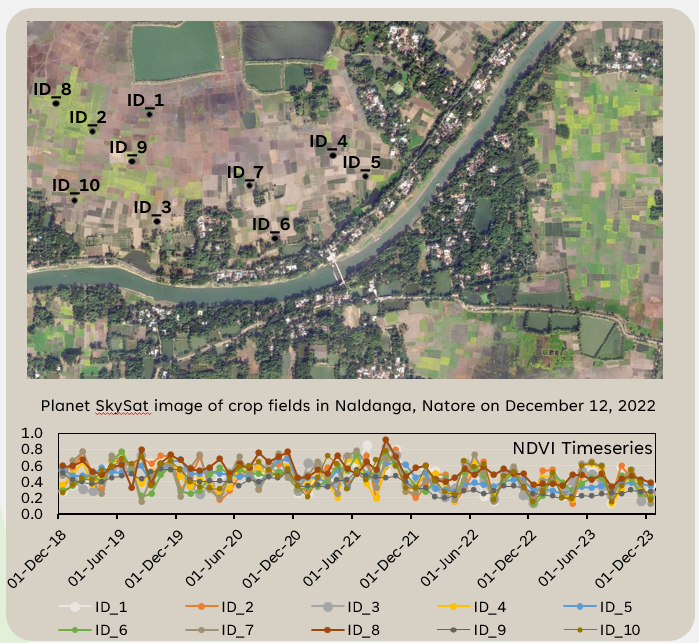
Bangladesh relies on agriculture, and the government’s goal is to ensure food self-sufficiency. Additionally, agriculture provides over 40% of Bangladesh’s jobs. However, sub-district-wise collected crop production and yield data are insufficient for analyzing crop yield distribution geographically. Time-consuming and laborious surveying is needed for such geographical investigation. Using Naldanga as an example of diversified land use patterns, BUET’s i-modeling group employed the Normalized Difference Vegetation Index and a deep learning system to estimate and predict crop yield during the 2021/22 and 2022/23 growing seasons. The project focused on enhancing agricultural monitoring and planning through advanced image processing techniques. Freely available low-resolution Sentinel-2 satellite images were used as input. A diffusion model was employed to transform these low-quality images into high-resolution equivalents, comparable to those produced by premium satellites like Worldview, PlanetLab. Dry and wet season drone images were captured for training and testing purposes. This improvement in image quality proved critical for accurately predicting the spatial and temporal distribution of crops. Using high-resolution images, the project achieved precise and detailed mapping of crop patterns across Naldanga region. This enhanced spatial distribution prediction will facilitate better resource allocation, such as optimized use of water, fertilizers, and pesticides, resulting in increased crop yields and reduced environmental impact. The approach will have extended benifits beyond individual farmers, empowering local agricultural agencies, such as BMDA, to make informed decisions. The project’s outcomes will contribute significantly to promoting sustainable agriculture and enhancing food security by leveraging high-resolution satellite imagery and state-of-the-art analytical tools.
Funded by Planet, this project was awarded to the Institute of Water and Flood Management (IWFM) from a competitive pool of 38 applicants across 13 countries, securing services equivalent to $15,000 in PlanetLab 3m resolution satellite imagery. The project involves collaboration with the Department of Computer Science and Engineering (CSE) at BUET, spanning one year, from September 22, 2023, to September 21, 2024.