
COMPLETED RESEARCH
Downscaling and analyzing satellite derived data against in-situ measurements: A step towards sustainable groundwater use in Bangladesh
Research Funding: RISE, BUET
Faculty Researcher: Dr Sara Nowreen
Collaboration: Lead: Department of Computer Science and Engineering (CSE), BUET. Affiliates: Institute of Water and Flood Management (IWFM), BUET
Duration: May 2023 - September 2024
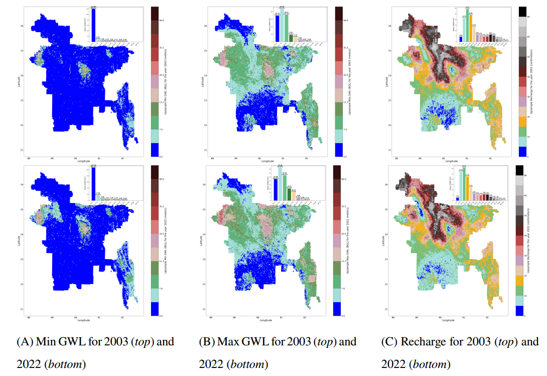
A novel model, GroundHog, has been developed to estimate high-resolution groundwater levels (GWL) by integrating coarse-resolution (25 km) GLDAS Groundwater Storage (GWS) data with grid-level and point-specific features. Outputs are delivered at a 2 km resolution, and the model is designed to be adaptable for any location or year within the GLDAS data period. As a precursor to GroundHog, alternative remote sensing datasets (e.g., Sentinel-1, Sentinel-2) were experimented with to address challenges such as cloud cover and nighttime imaging. A lightweight model was developed to extract NDWI from Sentinel-1, and a more advanced model, CloudBreaker, was created to reconstruct RGB and NIR bands from Sentinel-1, enabling NDVI and NDWI generation in the absence of optical data. Using GroundHog, high-resolution recharge estimates and temporal trends in groundwater levels were derived. A “Pseudo-Ground Truth” dataset was also generated by predicting minimum and maximum GWL at locations lacking in-situ measurements, which was instrumental in the training of GroundHog.GLDAS GWS data for the year 2024 were upsampled to produce high-resolution GWL estimates independently of officially curated in-situ measurements. A user-friendly web portal has been developed to ensure that model outputs can be accessed and utilized efficiently by researchers and policymakers.